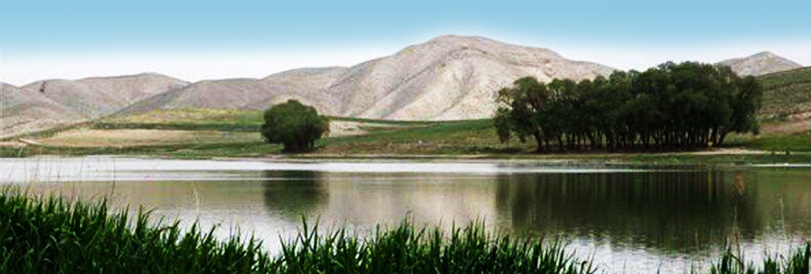
"Quri Gol" marshland is located km 30 Tabriz city, over the transit road of Tabriz - Tehran, and km 18 of Bostanabad. Located in the Bostanabad, the area of the drainage basin of this marshland is 3,146 hectares, itself is a piece of the catchment area of the Aji Chay river which is debouching into the Urmia Lake. The nearest villages to this marshland are Yousefabad and Omnab. The area for this marshland is stated between 160 to 200 hectares. This area has a dry cold climate.
There is no permanent river existing in the catchment area of "Quri Gol" and a large number of waterways are like watercourse and ended backwater. In addition, a large number of waterways (especially, a grid of canals at the western area) are lost before reaching the lake. This verifies our theory that we only have groundwater flows and interflows. If there was rainfall, thus, overland flows will start running on the large canals over a short period. In other scenarios, the transfer of water from canals to the marshlands will be through groundwater flows and interflows. The grid of canals leading to the lake can be divided into six canals. The largest canal with a length of 10 km is located in the western part of the area. These canals have a slop of about 7 to 8%, with a high erosion rate along its sides. There are 2 other canals in the southwest part of the lake, with a total length of 11 km. However, the two above canals are joining together near the lake, debouching into the lake at one point. In addition, there are 3 other canals, with a total length of 9 km, existing in the southern part of the lake. In the northern part, we have several small and short canals that guide overland flows of the flood to the northern part of the lake in times of rainfall. Due to temporary canals and underground backwaters, we will face difficulties in the assessment of water level. In the time being, the water level is calculated to be 2.9 million m3 considering the lake area of 160 hectares and a minimum depth of 1.8 meters. Regardless of the average changes in depth, the water level will be 3.6 million m3 due to the increase in the area to 200 hectares.
Physical properties
In the westernmost part of the Atrak catchment area in the north of Golestan province, there are three wetlands from the collection of international wetlands registered in the Ramsar Convention, close to each other. They are called Alagol, Almagol, Ajigol, which are also known as the collection of three international wetlands. These are the forty-ninth wetlands added to the list of critical international wetlands (Ramsar List), registered in the Ramsar Convention on June 23, 1975.
With an area of 2500 hectares, Alagol is the largest wetland of this collection and is located in a geographical position of 37 degrees and 22 minutes north latitude and 54 degrees and 35 minutes east longitude. The smallest wetland in this collection is Almagol, with 207 hectares and is located at 37 degrees and 25 minutes north latitude and 54 degrees and 38 minutes east longitude.
Ajigol, with 320 hectares, is located at 37 degrees and 24 minutes north latitude and 54 degrees and 40 minutes east longitude. Due to the new criteria of the Ramsar Convention, 1, 2, 5, and 6 criteria, and also, as they are considered examples of freshwater and brackish lakes belonging to the vast plains of the eastern Caspian Sea, these wetlands are of international significance.
There are lowlands in the wetlands also, and the environment around the wetlands is a steppe area where low-height dunes can be seen. All three Alagol, Almagol, and Ajigol wetlands are classified into salt, brackish, calcareous, seasonal/periodic lagoons; Seasonal / periodic freshwater lagoons and ponds; Seasonal / periodic brackish, brackish and calcareous lakes; Seasonal / periodic freshwater lakes; and wetland shrubs.
The altitude at the deepest point of Alagol wetland is 6 meters, and the maximum depth is 4.5 meters at the time of flooding. In most areas, the depth of Almagol differs from one to 1.5 meters, and at most, it is up to three meters in some areas. The western area of Ajigol is more profound than other areas, and its depth differs from one to 1.5 meters and a maximum of three meters in most places. Based on the De Martonne climate classification, this region is arid.
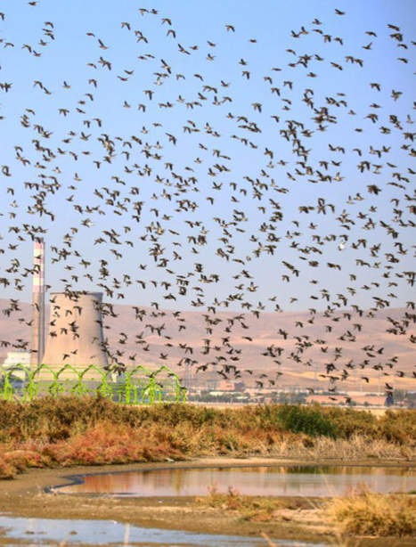
The average annual rainfall in the wetlands is about 263, and the average evaporation from the free water level of the studied area is about 1068 mm. All three wetlands are permanent and their water supply sources include rainfall, surface water, and regional effluents and Atrak river overflows. Therefore, they are classified as wetlands composed of surface water. The seasonal and temporary area and the bed of the wetlands have changed over the years. The most significant reasons for the increase and decrease of the wetlands water volume are the change of the Atrak river water regime due to drought and the construction of a dam upstream of this river, including in North Khorasan Province, which is one of the most critical threatening factors despite recent droughts. Overall, the soil of the area is considered saline and alkaline soil. Natural factors such as high static water level and human factors such as insufficient irrigation systems have been influential in the salinity of the Alagol region.
Management program
According to the experiences gained in other countries in developing a management plan, integrated ecological management can play a significant role in improving the condition of the country's wetlands as a modern scientific and practical method. The beginning of the comprehensive ecological management program of Alagol International Wetlands was fulfilled with the active and associative presence of various stakeholders in the form of holding workshops and creating the essential working groups.
To develop comprehensive management of the wetland, a series of workshops and also a process was operated, which was unique due to the participation of many responsible organizations and the local community and all stakeholders in the process.