 Download
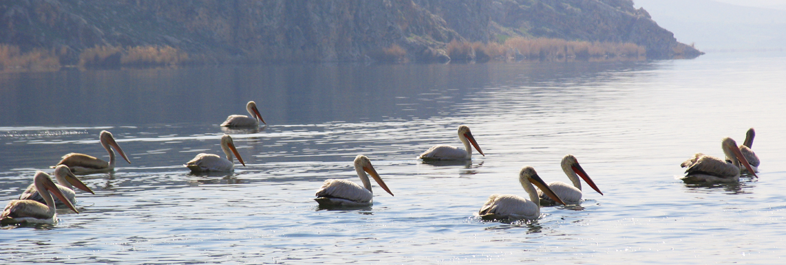
The Lake is located about 15 km east of
Kazeroun in a valley at the southern toe of the mountains locally known
as Div kan. It is more or less a topographical depression which forms
an elongated pan in between the shallow ridges in its eastern, southern
and western sides. The area is located in the semiـarid part of Iran
with short mildـtemperate winters and long hot and dry summers.
Precipitation regime of the area follows that of Mediterranean and major
part of precipitation occurs during fall up to spring months. Summer
months are generally dry. The catchment area of the Lake is about
270,000 ha. The surface area of the water body changes seasonally
according to the hydrological condition and generally varies between
more than 2500 ha to almost 5000 ha but historical documents show that
in some severe drought periods (1987) the entire lake has dried out. The
average annual precipitation of the area is around 450 mm ranging in
between 700220ـ mm/yr. The evaporation capacity in the area is high (on
average 2470 mm per year) and ranges in between 16003350ـ mm/yr. The
Lake is recharged by different sources including ground water flows,
precipitation and runoffs from surrounding areas. The geological
formations in the north of the Lake are of limestone nature which is
generally characterized by extensive fissures. This Karstic feature of
northern limestone causes several springs to appear in the eastern and
western sides of the Lake. Also, significant seepage flows directly
enter the lake from the northern slopes.
The Lake is generally a shallow water body with more or less impervious
bed. When fully inundated, the depth of water in its deepest part is
less than 5 meters. At low water level conditions, the depth of water in
the lake is generally less than 2 meters. The Lake does not have a
natural outflow and its main source of water loss is through evaporation
from water surface and consumption by vegetation cover. However large
number of water wells (more than 800) have been excavated around the
Lake and are exploiting significant volume of ground water for
irrigation uses which otherwise would recharge the wetland